Learn how GIS professionals use Global Mapper to visualize, analyze, and manage complex bathymetric data in real-world workflows.
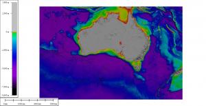
HALLOWELL, ME, UNITED STATES, August 7, 2025 /EINPresswire.com/ — Join Blue Marble Geographics® on Thursday, August 21, at 10:00 AM EDT for a webinar that dives into the world of bathymetry and terrain analysis using Global Mapper Pro®. This webinar is the first ever live show of the GEOTalks® Podcast, a series that aims to highlight the ways GIS users around the world solve spatial challenges. Whether you’re a seasoned hydrographer, a GIS professional, or simply curious about underwater mapping, this webinar offers a unique opportunity to learn from industry experts and see Global Mapper in action.
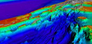
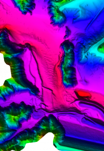
Co-hosted by geospatial expert Gus Cooke, this session will explore the accessibility of bathymetric data along with advanced tools in Global Mapper, such as 3D visualization and breakline integration. He will also demonstrate an in-depth workflow about how sonar or bathymetric lidar data can be loaded for in-depth terrain analysis, from custom shaders and terrain painting to utilizing the Path Profile tool.
The webinar will also feature insights from the team at Survey Systems, who will share how Global Mapper supports their hydrographic surveys of the Colorado Riverbed. Learn how they collect and process massive datasets, generate 3D terrain models, and perform quality assurance across multi-source survey data—all while preparing it for final export and analysis.
To conclude the event, we’ll host a live Q&A panel, where attendees can ask questions directly to our speakers. Joining the discussion will be Tomer Ketter, the Director and Co-Founder of Map the Gaps, who brings over 20 years of field experience in mapping remote underwater landscapes using cutting-edge GIS technologies. Tomer will share his insights into the evolving role of GIS in hydrography and bathymetry, along with his own expedition experiences. If you are eager to learn more about bathymetry, don’t miss Map the Gaps’ Ocean Floor Explore conference, taking place October 26–29, 2025, in Victoria, Canada—a gathering for bathymetric specialists and ocean mapping professionals from around the globe.
Don’t miss this chance to enhance your understanding of bathymetric workflows, explore real-world applications, and connect with a global community of geospatial professionals. Register today and be part of the conversation shaping the future of bathymetric mapping. If you would like to learn more about Global Mapper, contact our team for a free 14-day trial.
Jessica Vachon
Blue Marble Geographics
+1 207-622-4622
email us here
Legal Disclaimer:
EIN Presswire provides this news content “as is” without warranty of any kind. We do not accept any responsibility or liability
for the accuracy, content, images, videos, licenses, completeness, legality, or reliability of the information contained in this
article. If you have any complaints or copyright issues related to this article, kindly contact the author above.
![]()


